Making the best of best-laid plans gone awry
Published 6:00 am Tuesday, July 4, 2023
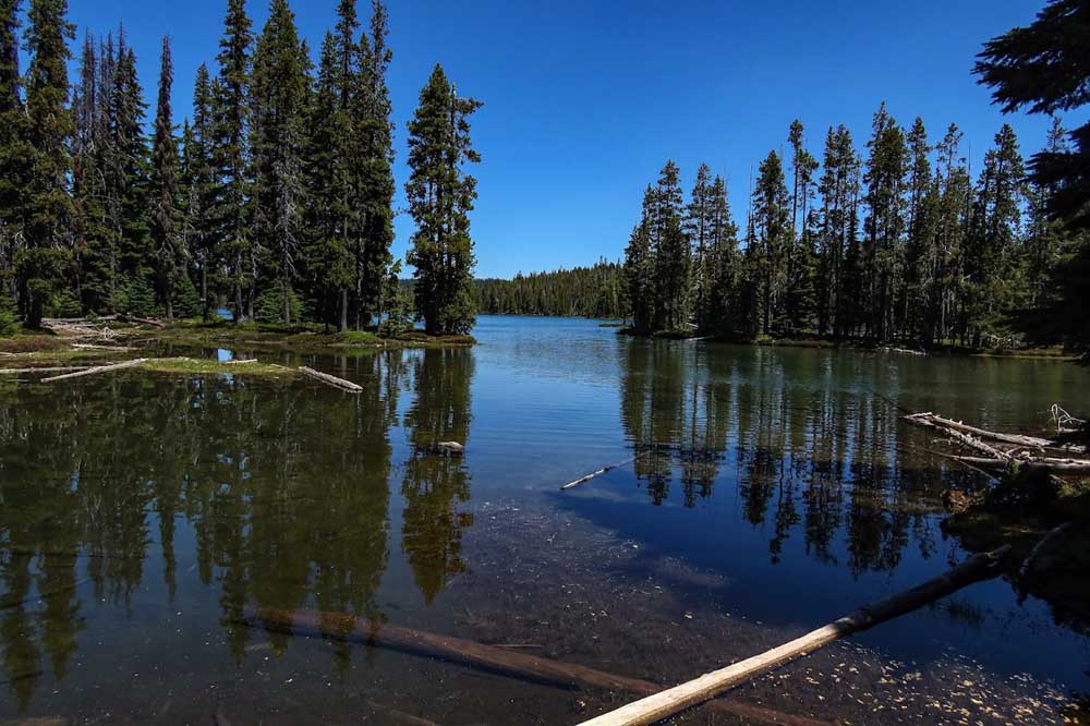
- The view from the south end of south Puck Lake.
Robert Burns was correct — sometimes the best laid plans of mice and men, not to mention hikers, do go awry.
Trending
Burns’ comments date back to 1785, but the Scottish poet’s words hold true all these years later.
Several of us had planned to take part in a hike for which our group leader had calculated the best-laid plans. But when he took ill and the hike was scrubbed the morning it was scheduled, we were flummoxed. Our lunches were packed, we’d dabbed on layers of sunscreen and mosquito repellant. Rides were arranged. What now? Stay home and fret?
No way, at least for three of us.
Trending
Our later-than-planned departure began when Danny Hawkes and I climbed into Diane Miller’s car. We headed to a different destination — Puck Lakes in the Sky Lakes Wilderness. The weekly trails report for wilderness areas on the Fremont-Winema National Forest by trails specialist Anthony Benedetti indicated the road to the Nannie Creek Trailhead was clear of snow, but indicated sections of the trail to the lakes had fallen trees.
It’s about 2.5 mostly uphill miles to Puck Lakes. As Benedetti’s report indicated, trees did block sections of the trail. A small handsaw, which we didn’t have, would have been adequate to clear most of the obstacles. Instead, we easily stepped over or walked around most of them, but other times we demonstrated our limbo-lower-now moves, shimmying under some. Others we climbed over, having to wriggle and waggle our legs and bodies in contortionist-mimicking moves.
From the trailhead parking area — an elevation of nearly 6,000-feet — the uphill, switchback route climbs through forests of Shasta red fir and mountain hemlock, gaining about 750 feet in the first 1.5 miles. Even after a good snow year, the first few patches of lingering snow didn’t appear until we’d hiked about a mile. The snow wasn’t a problem, but swarming nearby were small, hungry batches of mosquitoes. Once past the brief snow sections, the skeeters mostly disappeared.
Although it had been easy to step over or around the few trail-blocking trees in the first mile, we encountered more challenging obstacles shortly afterwards. Sometimes Danny, who’s taller, used his long legs to execute relatively easy step-overs, something Diane and I couldn’t do. But other times she and I benefited by being able to more easily duck or squat under overhanging trees.
After about 2 miles, the Nannie Creek Trail winds slightly downhill. The mostly unobstructed trail offered an unexpected surprise, a through-the-trees, barely visible but awe-inducing view of Mount McLoughlin.
No sign marks the turnoff to Puck Lakes, but we saw its brilliantly blue water from the trail. We followed a use-trail to a shady beach on south Puck Lake’s southern shore. Because of the recent snow melt, the trail to south lake’s northern end, where I’ve often camped, and north Puck Lake appeared wet and marshy. So, instead of continuing on, we lightened our loads by rehydrating and munching lunches at a pretty lakeside vantage, just steps away from clusters of vibrantly pink heather wildflowers.
Because of our revised plans and later start, after lunch we headed back to the trailhead.
Another surprise appeared near the trailhead parking area — a cavalcade of dogs and hikers. The moms and dads toted loaded packs while a smattering of very young boys and girls scampered up the trail. The kids’ puckish grins sparked memories of the decades-ago Puck Lakes backpack with my then 6- and nearly 4-year-old daughters.
Sometimes the best laid plans don’t materialize, but sometimes spontaneous, quickly devised plans are even better.
To get to the Puck Lakes from Medford, take Highway 140 toward Klamath Falls for 25 miles. Between mileposts 43 and 44, turn north on Westside Road for about 12 miles to a signed turnoff for the Nannie Creek Trailhead (Forest Road 3484). The gravel road goes about 5.5 miles to a parking lot/trailhead at the road’s end.
Marketplace


2025 Community Choice Awards

-
eEdition

-

-
