A (mostly) skeeter-free day in the Sky Lakes Wilderness
Published 12:15 pm Thursday, August 3, 2023
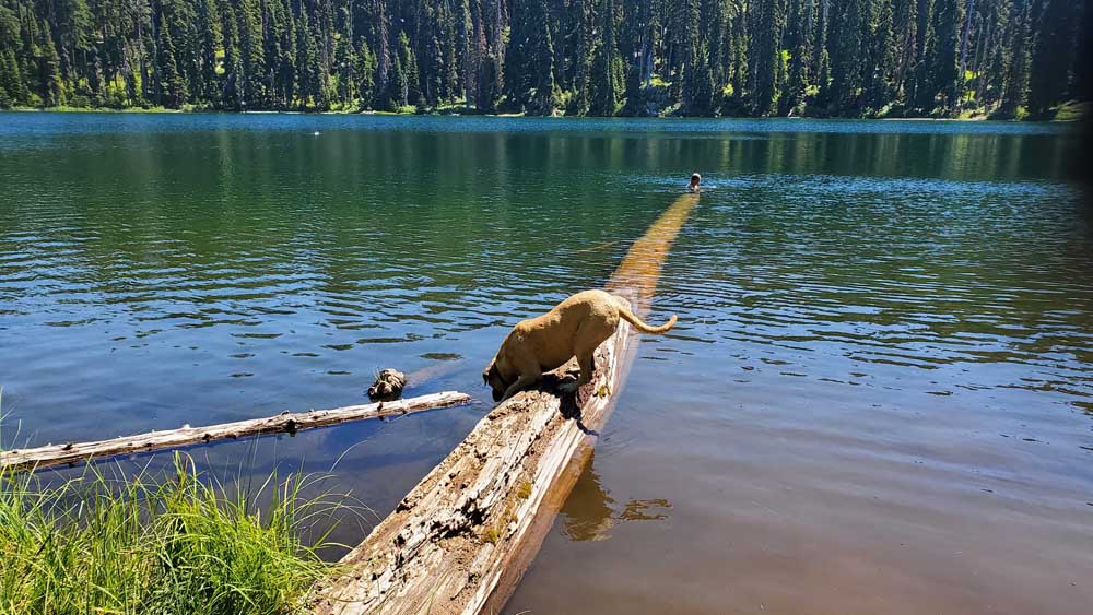
- Kenna checks out aquatic life in Blue Lake.
It’s midsummer, which means the high mountain lakes of Southern Oregon are warm enough for swimming without a wetsuit, and it’s also the time of year when mosquitoes in places like the Sky Lakes Wilderness turn from murderous to merely annoying.
Last Sunday, those factors led us to load up our daypacks and head to the Blue Lake Basin in the Sky Lakes for a stroll through the forest and an afternoon of playing in crystal-clear water.
The trailhead is about 60 miles from Medford, which should take about 90 minutes — definitely less than two hours — depending on your comfort level driving gravel roads in the national forest. It took us three hours to get there because — instead of using a good old-fashioned paper map and the directions provided by William Sullivan in his old but still very useful “100 Hikes in Southern Oregon” — we allowed Google Maps to guide us into a maze of goat trails that ended in a jumble of downed trees.
Once we backtracked and regained our bearings, our hike began in a sunny meadow buzzing with bees, butterflies and other pollinators working a wide assortment of wildflowers. The path quickly dived downhill into a lush, shady forest of towering fir trees. When we stepped from bright sun into the cooler air of the forest, we froze for a second, half-expecting to be engulfed in a cloud of buzzing bloodsuckers, something we have experienced more than once in the Sky Lakes. The wilderness area is named for the hundreds of large and small lakes that dot the landscape, and all of those lakes are breeding grounds for skeeters.
We had mosquito repellent handy, but nothing attacked us, so we put the bug juice in an outer pouch of a backpack where we could reach it quickly if needed.
The trail to Blue Lake is one of the easier hikes you can take in the mountains of Southern Oregon — especially in a wilderness area. Blue Lake is roughly 2.5 miles from the trailhead, and it’s mostly a gentle downhill that descends about 600 feet. On the way in, we passed through numerous huckleberry patches loaded with immature green berries. By the end of August, it’s possible this will be a great huckleberry-picking season, especially if we get any rain in the mountains this month.
Then again, the birds, squirrels, chipmunks, bears and other residents of the forest are waiting eagerly as well, so the competition will be fierce.
When we began our hike, there was just one other vehicle at the trailhead, and about a mile along the trail we encountered its occupants — a couple bearing fully loaded backpacks who had spent the past few days camped in the basin.
“How were the skeeters?” we asked.
“Medium,” they agreed. “Not a problem when you’re in the sun, and just a little annoying in the shade and in the evening.”
We bid them good travels and headed for a brief stop at Round Lake, a perfect watering spot for our bullmastiff Kenna. It’s a beautiful little lake full of life, 1.1 miles from the trailhead, but it’s too shallow for swimming, so we we let Kenna get her coat wet and take a long drink, then we continued another 1.2 miles down the trail to Blue Lake.
The backpackers were the last people we saw for several hours that day, leaving us to enjoy the pristine water of Blue Lake in blissful solitude. We played with the idea of heading down the trail for a couple more miles to visit Horseshoe Lake, Pear Lake and Island Lake. Island Lake, in particular, is always fun for us, because we love visiting the Waldo Tree. In 1888, Judge John Waldo and a team of explorers passed through the area on their way from Willamette Pass to Mount Shasta, according to Sullivan’s research.
While camped at Island Lake, Waldo’s group carved their names into a Shasta red fir, and the names are still visible today. The tree is 5.5 miles from the trailhead where we parked, which makes the roundtrip 11 miles. We’ll hit it the next time we’re there.
To reach the Blue Canyon trailhead from Medford, drive Highway 62 east for about 15 miles and turn right on Butte Falls Highway. Drive 15 miles to Butte Falls, then go one mile through town and turn left at the sign for Prospect. Travel nine miles east toward Prospect, then turn right on Lodgepole Road 34 and continue for 8.5 miles. Turn right on Road 37 for 5.3 miles of pavement, then another 2.1 miles of gravel. Then turn left on gravel Road 3770 for 5.3 miles to a parking area and pullout on the right.
More Outdoors


2025 Community Choice Awards

-
-
-