UPDATE: Salt Creek Fire estimated at over 3,800 acres, 16% contained
Published 10:00 pm Wednesday, July 10, 2024

- The Salt Creek Fire burning east of Eagle Point was infrared mapped overnight Monday at 3,300 acres, according to a Tuesday morning update from fire officials. Incident Management Team 1 Incident Commander Joe Hessel said local fire crews set up IMT1 for success.
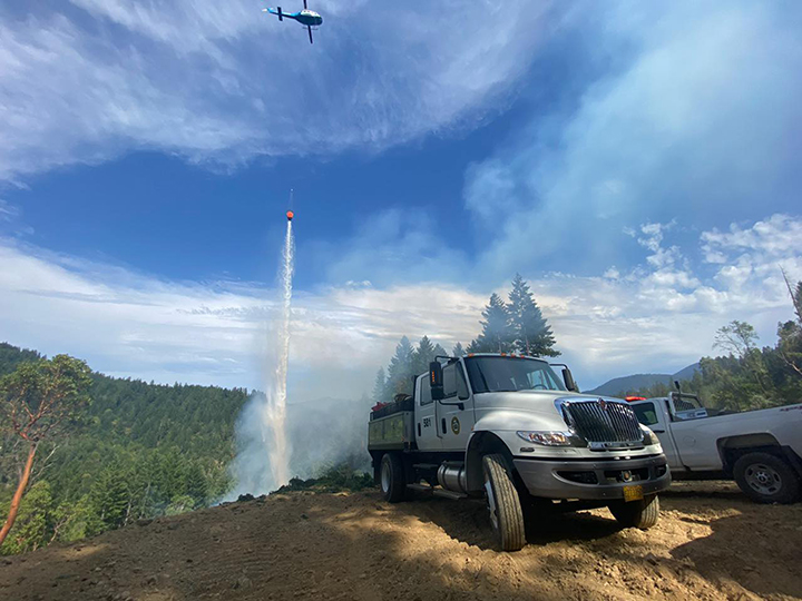
The Salt Creek Fire burning 10 miles east of Eagle Point has grown to about 3,815 acres, and firefighters now have the blaze about 16% contained, more than doubling this morning’s 7% containment, according to a Wednesday night update from Oregon Department of Forestry Incident Management Team 1.
Personnel working overnight total more than 380. Resources include “12 20-person crews, 22 engines, 10 bulldozers and 11 water tenders,” the update said. “Firefighters will continue to build on existing lines and strengthen them, which will increase containment.”
On Wednesday, firefighters toiled once again amid wind and high heat.
Two firefighters went to the hospital Tuesday to be rehydrated, while another did not return to the fire today, a Wednesday afternoon post said. Heat-related illnesses have affected several others, as well. ODF has medical personnel on the fire to respond to sick or injured firefighters, the post said.
The southeast corner of the Salt Creek Fire was firefighters’ focus on Wednesday as crews worked to establish both direct and indirect lines. Kyle Gibbons, ODF IMT1’s operations section chief, called that corner the “problem area of the fire” in a video posted to the Salt Creek Fire 2024 Facebook page Wednesday morning.
Wednesday night into Thursday morning, crews will continue working on “a small portion of line on the southeastern corner, where line has been difficult to build due to steep, rocky terrain,” the Wednesday night update said. “The goal of these operations is to complete this portion of line so mop up can begin.”
The fire broke out shortly after 4 p.m. Sunday, and its cause is under investigation. As of Wednesday night, the fire’s estimated cost is $2.9 million, the update said.
ODF IMT1 took command of the fire on Monday to allow ODF Southwest Oregon District crews to focus on new fire starts, according to an earlier release from the agency.
Jackson County Sheriff’s Office and Jackson County Emergency Management have issued an “Evacuation Level 1: ‘Be ready'” notice for Zones JAC-316, JAC-317, JAC-319 and JAC-321, ODF said Sunday.
The zones are north of Highway 140, approximately 12 miles east of Eagle Point in the Lake Creek area, east of Salt Creek Road, south and west of Fish Lake Road, including the Willow Lake area, the post said.
On Tuesday, Jackson County Emergency Management added evacuation zone JAC-325-A, largely located southwest of Esmond Mountain and bordering on the south at Highway 140.
Structural firefighters are on hand to protect homes in these zones, the Wednesday morning update said.
More info on evacuation zones can be found at Genasys Protect.
Salt Creek Road and Wasson Canyon Road are closed at Highway 140, ODF said, and Double Day Road is closed off at Butte Falls Highway. Highway 140 and Butte Falls Highway remain open, but officials urge residents to stay clear of crews working in the fire zone.
The fire danger level in the Southwest Oregon District switched over to “extreme” (red) on Tuesday.
The Shelly Fire in the Klamath National Forest in Northern California was listed at 8,736 acres Wednesday night and is 0% contained, according to the Inciweb website.
This is a developing story and will be updated as warranted.


2025 Community Choice Awards

-

-
-