Salt Creek Fire 41% contained as threat of thunderstorms looms
Published 9:06 am Sunday, July 14, 2024

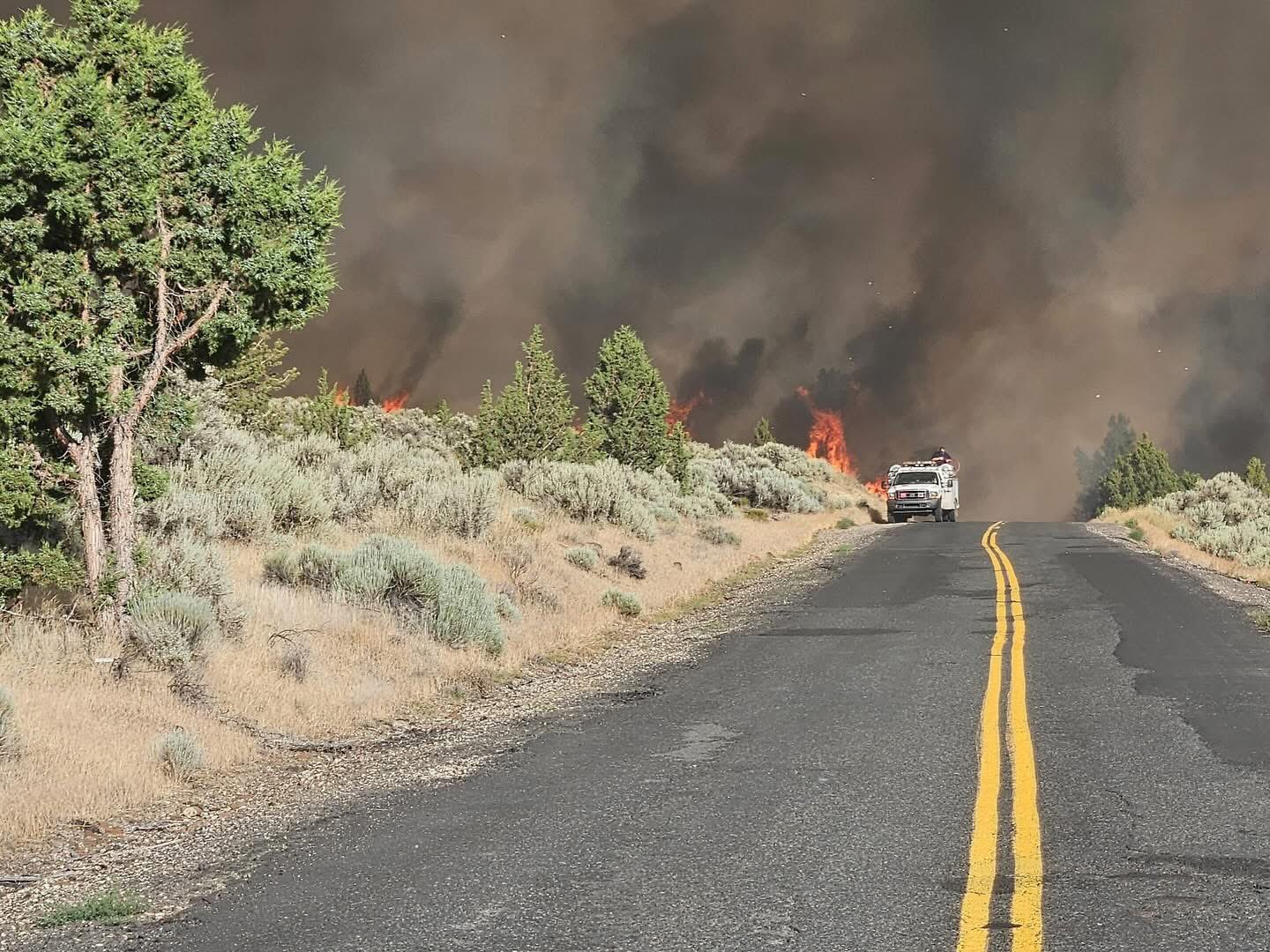
- A picture from the Oregon Department of Forestry shows a portion of the burn scare at the Salt Creek Fire east of Eagle Point.
The Salt Creek Fire 10 miles east of Eagle Point is 41% contained, and the Oregon Department of Forestry said Sunday that full mop-up operations continue amid the threat of thunderstorms.
Trending
The fire is listed at 4,081 acres and is fully lined, ODF said in a news release.
“Today, cloud cover will help to moderate the heat slightly, but also brings the threat of potential thunderstorms,” the release said. “Extremely dry fuels in the area and wind from these storms could cause any new fires to rapidly expand. Firefighters and equipment from the Salt Creek Fire are available to support initial attack response in the local area.”
More than 1,000 personnel are assigned to the fire, including 39 20-person hand crews, 35 engines, 22 water tenders, 13 tree fallers, 15 dozers and various types of logging equipment. This includes day shift and night shift personnel. Resources that are no longer needed for operations on the Salt Creek Fire are being released to be reassigned to other incidents across the state.
Trending
The cost to fight the fire was estimated Sunday at $8.4 million.
The Salt Creek Fire broke out shortly after 4 p.m. last Sunday, and its cause is under investigation.
On Thursday morning, the Bureau of Land Management Butte Falls Field Office temporarily closed BLM-managed lands in the area for public and firefighter safety, according to an earlier news release. Members of the public may not enter closed areas, and all uses — including hiking, hunting and dispersed camping — are prohibited, the release said.
The closure order encompasses BLM lands within affected evacuation zones. This includes BLM lands south of Butte Falls Highway, north of Highway 140, and east of Salt Creek Road to the U.S. Forest Service boundary. See the map for full closure information on the BLM website: https://www.blm.gov/orwafire.
The Jackson County Sheriff’s Office and Jackson County Emergency Management have issued an “Evacuation Level 1: ‘Be ready'” notice for zones JAC-316, JAC-317, JAC-319, JAC-321 and JAC-325-A, and those notices remain in effect, ODF said Saturday.
The zones are north of Highway 140, approximately 12 miles east of Eagle Point in the Lake Creek area, east of Salt Creek Road, south and west of Fish Lake Road, including the Willow Lake area.
Salt Creek Road and Wasson Canyon Road are closed at Highway 140, ODF said earlier this week, and Double Day Road is closed off at Butte Falls Highway. Highway 140 and Butte Falls Highway remain open, but officials urge residents to stay clear of crews working in the fire zone.
The fire danger level in the Southwest Oregon District switched over to “extreme” (red) on Tuesday.
The Shelly Fire in the Klamath National Forest in Northern California was listed at 14,309 acres early Sunday afternoon and is 2% contained, according to the Inciweb website. There are more than 2,700 personnel on scene, as reported Saturday, and evacuation warnings are in place for multiple areas.
Marketplace


2025 Community Choice Awards

-
eEdition

-

-
