WILDFIRE UPDATE: Ukiah under ‘be ready’ evacuation notice
Published 4:45 am Friday, July 19, 2024

- Evac Levels.jpg
UMATILLA COUNTY — The Umatilla County Sheriff’s Office the evening of Thursday, July 18, reported firefighting crews in the Pilot Rock/Juniper Canyon fire completed burnouts around the fire to secure homes, infrastructure and agriculture.
Trending
The fire was 19,000 acres, according to the newest size estimate from the sheriff’s office, and comes with a cost of $272,350. While agencies have reported lighting caused the fire, the sheriff’s office reported the cause is under investigation.
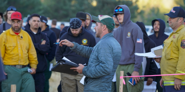
A total of 83 personnel are working to suppress the blaze using 26 fire engines and more.
A “Go now” evacuation level remains in effect for the area south of Coombs Canyon Road and north of Carney Butte between the county line on the west and just west of East Birch Creek.
Trending
The sheriff’s office also reported the town of Ukiah in southern Umatilla County is under a “be ready” evacuation notice.
The Battle Mountain Fire Complex is burning near the town, according to the Umatilla National Forest.
The complex as of the evening of July 18 was approximately 2,000 acres, with one fire burning 6 miles northwest of Ukiah and another 6 miles southwest of the town. The Umatilla National Forest also reported the Oregon Department of Forestry Incident Management Team 3 has been deployed to suppress the fire.
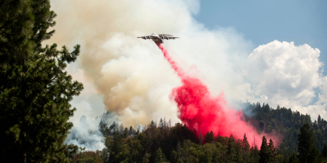
Crews were using dozers, engines and retardant to control the fire. The complex had reached the Ukiah Ranger District on the southeast edge of the Snake Fire.
The Oregon Department of Transportation on tripcheck.com reported Highway 395 is closed north and south between mileposts 50 and 90 due to the wildfires.
Other fires on the Umatilla National Forest
• The Lone Rock Fire is approximately 77,000 acres with a 10% containment 10 miles southeast of Condon.
Significant fire behavior emerged July 18, leading to notable fire growth to the south crossing the Heppner Ranger District. A complex incident management team working to suppress the fire with ground crews focused on structural protection and fire spread.
For information, contact the Fire Information Line at 541-208-4369, send email to 2024.0404rvlonerock@firenet.gov or visit Facebook: www.facebook.com/people/Lone-Rock-Fire-Information/61562972126530/.
• The Cougar Creek Fire is approximately 4,000 acres and is 23 miles southwest of Asotin, Washington. As of the night of July 17, the fire reached the Pomeroy Ranger District near Wenatchee Creek. A complex incident management team took command of the fire the morning of July 18 with crews working to suppress the fire. For more information, contact the Fire Information Line at 509-210-2928 or send email to 2024.cougarcreek@firenet.gov.
• The Buck Mountain Fire is 21 miles south of Walla Walla. The Umatilla National Forest is working on getting resources there. It is 0% contained and in difficult terrain. Aviation resources, rotary and fixed wing, are providing retardant and water to suppress the fire while crews are working their way in. The Buck Mountain Fire is a different fire than Buck Creek Fire, which was 100% contained on July 12.
Fire officials are responding to 11 other fire starts across the Umatilla National Forest due to the lightning strikes July 17. These range in size from ¼ acre to the 300-acre Monkey Creek Fire. Further information will be made available when conditions are known.
The fire danger rating is at “extreme” and public use restrictions phase B for the Umatilla National Forest is in effect.
And the National Weather Service has issued an excessive heat warning from 11 a.m. July 20 until 10 p.m. July 22 that covers most or all of Gilliam, Morrow, Umatilla, Union, Wheeler, Grant, Baker, Wallowa and Malheur counties.
Marketplace


2025 Community Choice Awards

-
eEdition

-

-
